trek

Durham Regional Forest

Durham Regional Forest, Walker Woods and Glen Major

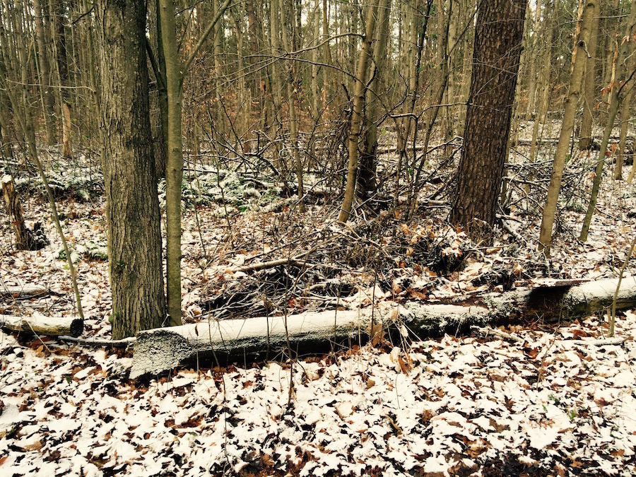
On a cloudy and cold November-14, I set out to hike a distance of about 25 km at the Durham Regional Forest , Walker Woods and Glen Major areas. I undermined the weather at a cost because in the adjoining forest area it had snowed the previous night, with a high temperature of only around 2ºC. I went easy on the warm clothes because the hike makes you sweaty after all. Also this was a fast hike where a consistent speed of about 5.5 km/h had to be maintained all throughout.

This hike was expected on a hilly terrain but not biking trails which meander endlessly up and down slopes. It makes a long hike challenging with the prevailing weather system. The fallen leaves hide tree roots invisible to naked eyes, and at a faster pace on the slippery leaves, one can could trip and fall. As I tumbled today while attempting a fast descent on a slippery, rocky slope that wasn’t even part of the biking trail. I landed on my back and my right thumb got smashed badly in the sudden fall. I was so stunned by the plunge over the slope that I wasn’t even aware what had happened until about a few minutes later. I think I should be doing okay in a few days.

At 12:30 PM, around the halfway distance mark we all settled on the dry grass near an old barn for a 10-minute short lunch break. We were looking to shelter ourselves from the cold winds but brief stops such as these make you colder in no time, while the Sun showed up only momentarily to brighten things up. Surprisingly while we were all focussed on our munching, a golden retriever came out of nowhere from the field, dashed towards us and started sniffing around the group. He obviously got a whiff of the meals and decided to have a share of it. We were only too glad to do the honours and he disappeared in the shrubs wagging his tail merrily. But reappeared minutes later with three of his doggie friends! He may have shared the news of some Good Samaritans beside the old barn offering free food. Unfortunately we had finished our lunch and were ready to hit the trail by then. It isn’t uncommon for owners to let their friendly dogs off-leash in these parts of wilderness. We continued meandering through the Walker Woods and Glen Major forest and the endless biking trails again. The serpentine trails would often break into forks at several places and Arnie, our group leader would look at the skies to decide on the direction to take. Thankfully at every few kilometres of the nature trail the park authorities have set up wooden masts with a unique number and a small map of the trail around which corresponds to our location and onwards – the map shows the unique pole numbers and the direction so the travellers could decide where they would like to go. The ever so indulgent group would collectively surround the measly shaft for a lengthy discussion on the next steps. The Sun outnumbered by the clouds wasn’t helping us much but the maps on the numbered posts provided stronger clues on the trail towards the parking lot where our hike was culminating. We were told to look for a pair of communication towers on the northern end of the trail from where the parking lot would be about 2.5 kms. When we saw the towers it raised my hopes and infused a new vigour to continue marching on with an even greater force towards the goal. Between washroom breaks and the odd humour, the group managed to keep up the pace and stayed together until the end of the hike. The sun never showed up afterwards and the cold wasn’t something to write home about.

Personally, my thumb episode took the focus and fun away from the hike. I couldn’t indulge completely on the trail then or the landscape which was the saddest part of the journey. The elevation wasn’t much although there were some hills but mostly biking trails. And the faster pace on the slippery leaves along the ever-changing terrain ensured limitless challenge for me. Despite everything this hike would stay a memorable one for me for different reasons.

Featured Photo Courtesy: © 2015 Bhooshan Pandya. Should Not Be Reproduced Without Permission.

The Mystical Sai Kung

A hike through the woods is generally considered by countless individuals to be a leisure activity, one which cannot replace active sports for gaining body fitness. But you cannot be oblivious to the fact that traversing rugged terrain on foot, taking in fresh air & exploring the secrets of nature, can have a calming effect on the mind and body. Also as I learned from this hike of the Sai Kung peninsula in Hong Kong, it tested my human endurance skills- in the likelihood that you’re away from the pleasures of a city life, your mental & bodily fitness will be tested surviving the heat & exhaustion & in fighting the elements of nature. And with limited supply of water & food, it’s a challenge that every hiker faces.

Now anyone who characterizes Hong Kong with its towering constructions, night life, exquisite global cuisine & stark modernity is mistaken, Sai Kung should help change that perspective of this urban landscape. It is Hong Kong’s (secret) ecological pocket, tucked away in the farthest corner of New Territories, a splendid basket of greenery, fauna & the sea decorated with islets.

Through the 1960s the Sai Kung peninsula was largely untouched by civilization save for the natives around here, the only way to reach this area was by foot or ferry (‘Kai-To’ still remains an important mode of transport connecting Sai Kung’s outlying islands). In the 70s the High Island Reservoir was built to alleviate water shortage to Hong Kong city. Consequently 2 roads were constructed that will make the remote parts of Sai Kung accessible to outsiders for the first time. Today there are camping sites within the jungle providing safe cover for nature enthusiasts.

If you’re an admirer of nature like me, you can choose from the various hiking trails at Hong Kong-  there are 4 of them including the Maclehose Trail, that range from the easiest to the strenuous to the challenging. And depending upon the time on your hands & your temperament, each route could test your endurance for survival and take you about 3 to 6 hours to complete. A strong reason why you are advised to carry ample water & food that would last the entire stretch. Also a rucksack to carry the load on your shoulders & good footwear so you don’t get exhausted easily. I did not apply my mind to the situation & ended up with only 500ml of water. And some biscuits, that were provided by some softhearted folks I made friends with on my way to Sharp Peak. We will come to that story later.

There are 4 nature trails originating in the Sai Kung peninsula, each one is more scenic than the previous (this is a part of the Maclehose Trail). Hikers can choose to go to Hoi Ha Wan Marine Park where the water quality has allowed marine ecology like corals (39 of the 50 recorded corals can be seen here) & mangroves to flourish. Also an ideal spot for snorkeling. Ma On Shan is another haven for trekking aficionados, the trail runs through the Ma On Shan Country Park along the steep misty hillsides. Its a treat for nature lovers with Ma On Shan’s northern ravines offering native habitats. The High Island Reservoir is another spot, hikers can enjoy the scenic trail which runs around the coast line- a true mix of the scenic coastal view & the green slopes lying side-by-side.

I chose to make the trip to Sharp Peak having sparse idea about the challenge lying ahead. As an avid photographer on tour, I’m habituated to walking longer distances for a great photo, sometimes taking the concepts of tough terrain & weather lightly.

The trek to Sharp Peak begins at the Sai Kung bus terminal, with bus 94 (Wong Shek Pier) and getting off at Pak Tam Au. The hike starts across the road which is a graveled track. But be sure to carry your own supply of water & food, I was shocked to find the vending machines, stacked with food & drinks but in terrible condition.

Out of my foolish instinct, I took a rocky trail that led me to the most impregnable foliage. I’d given up on the idea of continuing fearing the unknown & had decided to return when I met 2 hikers on the same route, I decided to join them. They turned out to be my saviors supplying me with information about the area & even food. One of them was a student of Yoga and had visited India before, it had become much easier for him to connect with my traditions & culture (not that it matters but he turned out to be a vegetarian too).

Sharp Peak lies in the Sai Kung East Country Park (4,477 hectares), rising at a height of 468 metres its difficult to lose sight of it at any given time. The trail to Sharp Peak covers a distance of 12 kilometers at an extreme height and takes about five hours to complete (you can get more details in ‘Exploring Hong Kong’s Countryside’ by Edward Stokes). However due to the late start & practically no prior preparation I opted for reaching Tai Long Wan beach, which was adjacent to the Ham Tin village.

Along the way I found deserted villages, it’s residents had long opted for the city high life & moved on. The houses that once sheltered families & hopes had been reclaimed by nature. The neighborhood was eerily hushed except for the odd chirping of birds & the passing breeze. The waves lashing at the abandoned boat tied to the pier. And some packs of dogs, silent & non-aggressive. However in some villages like Tai Long, it seemed there were few who had decided to stay on despite the pressures of the luxurious city life. The normal stink that accompanies human settlement wasn’t evident, the air was fresh, the aroma of the leaves & the soil was overpowering. The flow of the clear water stream along with the broken twigs & fishes was seductive, this was mother earth in her most divine embodiment. The mid afternoon sun had just added to her glow.

The stretch before Tai Long village is grueling. It descends into a valley continuously, which makes walking the descent a treat but not the steep climb while returning. There aren’t enough areas to rest on the arduous track except for the odd boulder on the sideway & the fence for support. Be assured that, you’ll need to rest at regular intervals, to calm your heartbeat and filling your lungs with fresh air before moving on.

After an exhaustive stroll through the woods, countering hillsides & buzzing insects, I finally reached Ham Tin village, which just like it’s predecessors had very few inhabitants to welcome me, the village wore a derelict & deserted look. But the well-equipped restaurant on the sea front, most probably a family run venture, stood there inviting me to rest my weary limbs. It wasn’t to be. Like a pirate crazed at the sight of treasure, I stood still gazing at the sea, ready to embrace her. Nothing could have stopped me at that point.

I’d one last hurdle to cross. Still staring straight at the vast South China Sea, I’d to cross a dilapidated bridge made out of poorly conjoined wooden planks on a shallow creek. I wasn’t ready for this but I had no choice. I started my catwalk, holding onto the ropes (and a prayer on my lips). Having finally connected with the environment in myriad ways, my sojourn to Tai Long Wan & Sai Kung had come to a satisfying end. As I made my trek back to where I started, I threw a glance at the tall mountains thanking them for making my journey the most memorable for a lifetime to come.

When Nature Calls

Karnala FortThe God who painted nature in its varied hues and moods is the greatest. He must’ve worked painfully hard to produce such flawless beauty which entices the human mind, even though he may not be physically present there. He then blesses us with rains & cleanses his creation to its original form and welcomes us to enjoy it. To my mind, this is definitely the season to be one amongst nature.

Continue reading…