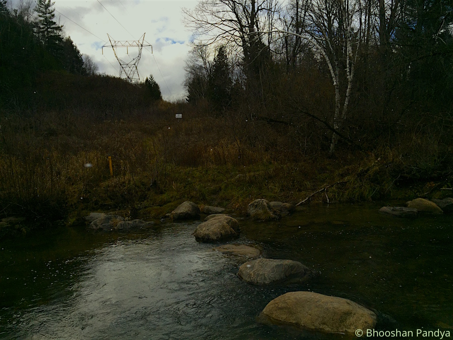
It was a cold November morning when we reached the Concession 3 parking lot of the Seaton Trail to begin our 26km hike today. The Seaton Trail, with a distance of 12.9 km from 3rd Concession near Brock Road northwest to Highway 7 at Green River is owned by The City of Pickering and managed by the Whitevale Community and Grand Valley Park.
I noticed a remarkable sight about the place when I looked around – it was swamped with dogs! And I realized that’s because of an Offleash Dog Park within the Seaton Trail area. And before I knew what was going on I was dashing against my furry buddies on the trail as they were scurrying around enjoying the freedom and fresh air. I also suspect they were keeping themselves warm by zipping in the wintery morning.
The trail is marked with blazes as well as numbers all along the official route, so getting lost was almost next to impossible, but still one needed to keep a watch. The numbers I was referring to corresponded to the trail we were taking. For instance ‘3N013′ would mean:
– 3 (Whitevale to Green River section)
– N (Northbound direction; S would be Southbound)
– 013 (sequential number of the trailhead)
There were also blazes – a Single blaze meant the trail proceeds straight and Double Blaze would signify oncoming turns; left or right, depending upon the placement.
The cold weather and the winds were unrelenting. Within the first 15 mins of the trail I met a steep, never-ending hillock where I had to start dealing with a running nose and which would be an endless exercise throughout the hike. As well as certain muddy patches due to the overnight showers (we were informed about this situation) that provided some challenge for me. The plunge I had taken during the hike last week was still afresh and though I did slip a few times in the mud it wasn’t much serious but did race my heart a bit. At one point, we had planned to cross the West Duffins Creek stepping on large boulders to make the trail interesting, but unfortunately the waters had risen quite alarmingly almost submerging the rocks. Some adventurous hikers in the team brought along a tree log from the bushes in trying to form a bridge. But that plan was dumped as quickly as it materialized because the log was very unstable and it would have caused a human disaster of an unimaginable size.
The terrain along the densely wooded area disguised itself with leaves and tree roots that reminded me once again of the Durham Regional Forest (but no biking trails this time). Also a reminder that I should be cautious in deciding my next steps (literally). We were supposed to keep up a speed of 5.5-6kmph all along the way but found that some members had started to feel the exhaustion quite early and we had to stop at regular spots to let others catch up. This became more prevalent when we headed back towards the starting point post-lunch. After a long arduous walk in the flurries and wet terrain, we settled in a dingy shed at the Whitevale Park for our meals. The flurries had given way to a nice snow shower which came down heavily. The green park was bathed in white, and so ravishingly. My hands were freezing outright as I tried to munch ferociously on the Falafel burrito and finish it faster so I can get my hands tucked inside my jacket as quickly.
As we continued beyond the park we took deviated from the main trail to explore the Whitevale Dam, where I quite ignorantly assumed we had reached the end of the trail to turn back. A really simple and a short dam built to offer a physical barrier to separate migratory fish species such as rainbow trout and chinook salmon (downstream of the dam) from native brook trout (upstream of the dam). At which point the Sun came out briefly as we scanned the beautiful marshy landscape near the dam, as the flurries returned. Continuing onwards to Green Park parking lot the path became more smoother and muddier once we passed under the 407. It was around 1-1:15 PM when we reached the destination to turn back. We had maintained a steady pace of 5.5-6kmph which still did not satisfy certain members of the group. They wanted the pace quicker! Nevertheless given the muddy and hilly terrain I thought I had done well, though admittedly my confidence levels were at an all time low criss-crossing the swampy patches.
We turned around to go back. At this pace it was likely that we would reach the starting point at the Concession 3 parking lot by 4:45PM. After we passed the Whitevale Park (where we had our lunch before) I took the lead with another member until the Clarkes Hollow Parking. We went with such ferocious pace meeting the trail bends and the hillock, almost jogging through the woods, that the distance between us and the rest of the group widened. We had no choice but to wait for them and take a breather. The downhills before had now become uphill leading to even steeper climbs post the lunch period. The exhaustion had begun to set in for some members, and quite rightly so, while I was working hard to keep the momentum from dropping. The exhaustion wasn’t personally felt until I reached the end at 4:15-20PM but it wasn’t as much as a little soreness. We had picked such amazing pace that despite the halts we took we still managed to save 30 minutes from the overall hike time. It was yet another awesome hike that ended, that goes straight into my book of memoirs.

